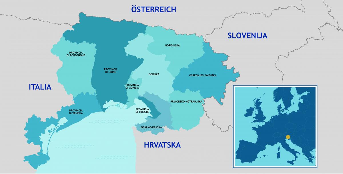
The reduction of the Programme area brings the Programme to its previous INTERREG II and INTERREG III geographic configuration.
The new territorial dimension could help to strengthen the cohesion level of the Programme area and better focus strategic approaches and actions on the three pillars of concentration, territorial connection and administrative cooperation.
The Programme area extends over a total surface of 19,841 km² and has a total population of approximately 3 million inhabitants. The entire Programme area includes 5 Italian NUTS3 level regions (provinces of Venice, Udine, Pordenone, Gorizia and Trieste) and 5 Slovenian statistical regions (statistical regions of Primorsko-notranjska,Osrednjeslovenska, Gorenjska, Obalno-kraška and Goriška). Overall, on NUTS2 level on the Italian side, the regions involved are those of Veneto and Friuli Venezia Giulia, while for the Slovenian side, Vzhodna Slovenija and Zahodna Slovenija.
The cooperation area includes various models of territorial development. A specific example is
the functional urban region of Gorizia, Nova Gorica and Šempeter where, drawing on the experiences achieved through several European cross-border projects, an EGTC (European Group for Territorial Cooperation) has been established in 2011. The EGTC, considered the most advanced form of cross-border territorial cooperation, shares goals relating to common management and modernization in health, environment and infrastructural sector, urban transport, logistics, energy and economic development initiatives.
The geographical coverage of the Programme area is characterized by an internal diversity with the presence of coastal areas, mountain ranges, rural and urban areas, and lagoon landscapes.
